 |
 |
Registration Link (Deadline: 21 Oct 2026, Wednesday)
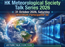
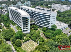
The HKMetS will host a talk on ‘Weather & Climate Monitoring and Sustainable Smart Campus’ at HKUST, followed by a visit to Hong Kong’s Largest Liquid Cooling System.
Date: 31 October 2026 (Saturday)
Starting Time: 2:00 PM
Venue: Main Academic Building, HKUST
Language: English (Chinese complemented)
Maximum participants: 30
|
 |
 |
香港氣象學會參觀交流團報名表格(截止日期: 2026年10月26日)
香港氣象學會擬於2026年12月12日(星期六)籌辦交流團參觀廣州市氣象綜合保障中心(廣東省突發事件預警信息發布中心)。誠邀會員參加,活動詳情及報名方法請參照連結:
https://forms.gle/CydKKXb8pS5o4Kvf6
為免向隅,報名從速﹗
|
|
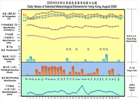 |
The Weather of August 2026 — An August with record-breaking high temperatures
Attributing to the warmer-than-normal sea surface temperature and the southwesterly flow in the lower atmosphere over the near region of HK, as well as the high temperature weather brought by the outer subsiding air of Tropical Cyclone Dolphin, August 2026 in HK features a monthly mean temperature of 29.5 degrees, which were 0.8 degrees above the normals. This month recorded nine consecutive very hot days from 5 to 13 August, marking one of the longest consecutive periods on record for the month.
|
|
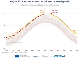 |
August 2026: World’s joint hottest month on record
August 2026 was the joint warmest month ever recorded, tied with July 2023. The month also saw the joint highest monthly average SST ever recorded across the extra-polar ocean, tied with March 2024, and the highest daily global SST over the extra-polar ocean ever recorded, at 21.11ºC. Meanwhile, record high SSTs were seen across the tropical Pacific, an area where a potentially extreme El Niño event continues to intensify.
|
|
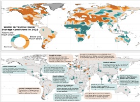 |
Recent water trends have serious future implications — 2025 State of Global Water Resources Report
Rivers across the globe in 2025 had one of the driest years in more than three decades, reported by WMO. The water cycle has become more erratic and unpredictable, swinging between too little or too much. The past seven years have seen the fewest rivers with “normal” flows since 1991. Asia and Africa together accounted for at least half of all recorded water-related extreme events and more than 80% of reported associated deaths over the past five years.
|
|
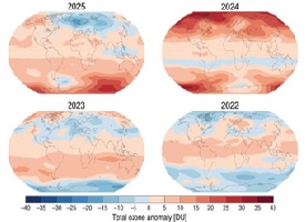 |
WMO bulletin shows successes and challenges in ozone layer recovery
The Antarctic ozone hole in 2025 was one of the smallest in decades – testimony to the continuing success of international action to protect the Earth’s ozone layer which shields us against the sun’s harmful ultraviolet rays. In the Northern Hemisphere, total column ozone in 2025 was below average in a large region extending from Greenland and Europe to the Kamchatka Peninsula. These variations occur within the long-term trend towards the healing of the ozone layer, reflecting the success of the Montreal Protocol.
|
|
 |
El Niño just leveled up to super status
An already-strong El Niño just turned super as the phenomenon crosses into unprecedented territory. The latest weekly Niño 3.4 Relative Oceanic Niño Index value hit 2.0 degrees Celsius above average. An active Pacific hurricane season that’s churned out multiple threats for Hawaii, a hurricane-less Atlantic hurricane season to date and Indonesia’s overwhelming wildfires are just a few effects of this very strong El Niño. According to NOAA, El Niño has a 75% chance of peaking by end of this year since records began in 1950.
|
|
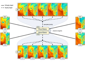 |
HourGlass: filling in the gaps between forecasts
A forecast valid at noon and another at 18:00 cannot tell us everything that happens in between. Many AI weather forecasting systems provide forecasts only every six hours. HourGlass, a new data-driven probabilistic temporal downscaling method developed by MET Norway and ECMWF enables hourly forecasts of key surface variables for both AIFS Single and AIFS Ensemble – preserving the skill of the underlying forecasting systems while producing temporally coherent hourly forecasts with realistic small-scale variability.
|
|
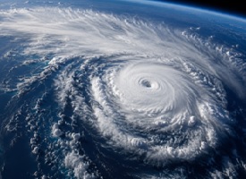 |
HKU Study — Atmospheric Dryness Constrains Typhoon Rainfall, Lower-Than-Expected Increases
Under global warming, scientists have widely expected tropical cyclones to bring more intense and frequent rainfall. A new study led by HKU and Imperial College London has uncovered a key missing piece of the puzzle: increasing atmospheric dryness. They found that as the climate warms, tropical cyclones become less efficient at converting moisture into rainfall.
|
|
 |
Membership renewal is now more convenient
Payment through Faster Payment System (FPS) is now available (Our FPS ID: 166920512). Support your society, don’t forget to renew your membership!
|
|
通訊錄的文章只以文章原本的語言表達。
The news in the Newsletter will be presented in the originating language only. |